![]()
![]()
![]()
![]()
![]()
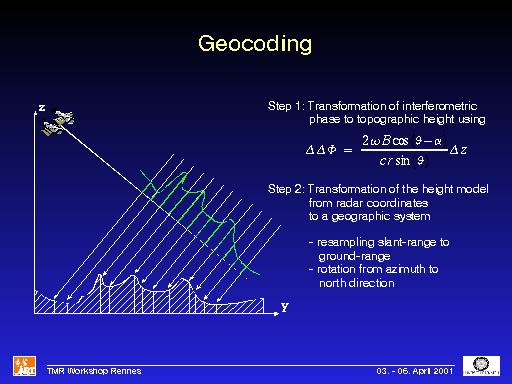
Comments: The final step in generating a DEM from SAR data is the geocoding of the data. Geocoding needs two steps. The first one is the conversion of the measured phase values to a topographic height. The second one is the transformation of the obtained height model from radar coordinates to a geographical coordinate system of choice. This is mainly a resampling and a rotation step.