![]()
![]()
![]()
![]()
![]()
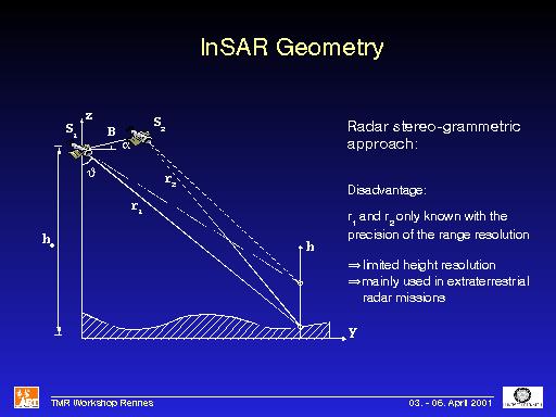
Comments: The disadvantage of this approach is of course that it depends strongly on the precision of r1 and r2. These are only known with the range resolution of the SAR, i.e. with a precision of several meters. This limits the achievable height resolution to values of around 100m, although better resolutions are possible with high-resolution airborne systems. Nevertheless, this method has widely been used, especially in extraterrestrial mission. For example, a DEM of the cloud-covered venus was generated using radar-grammetry.